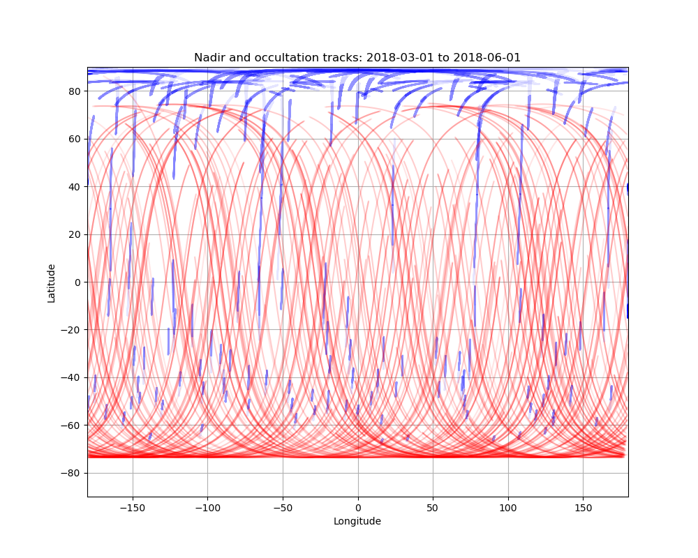
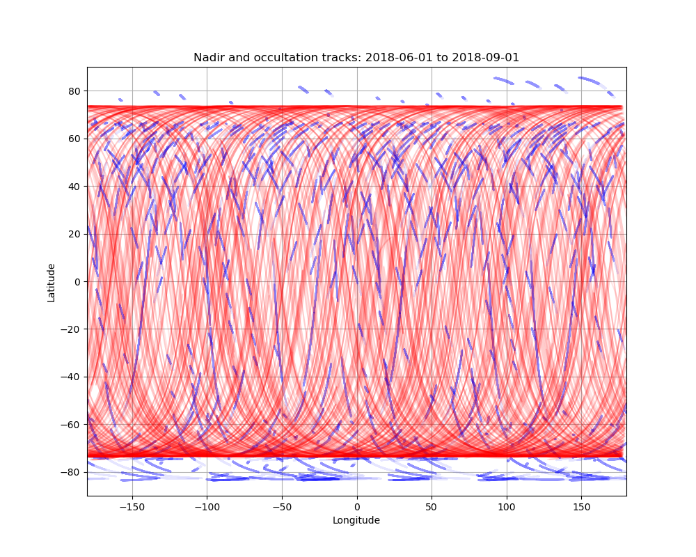
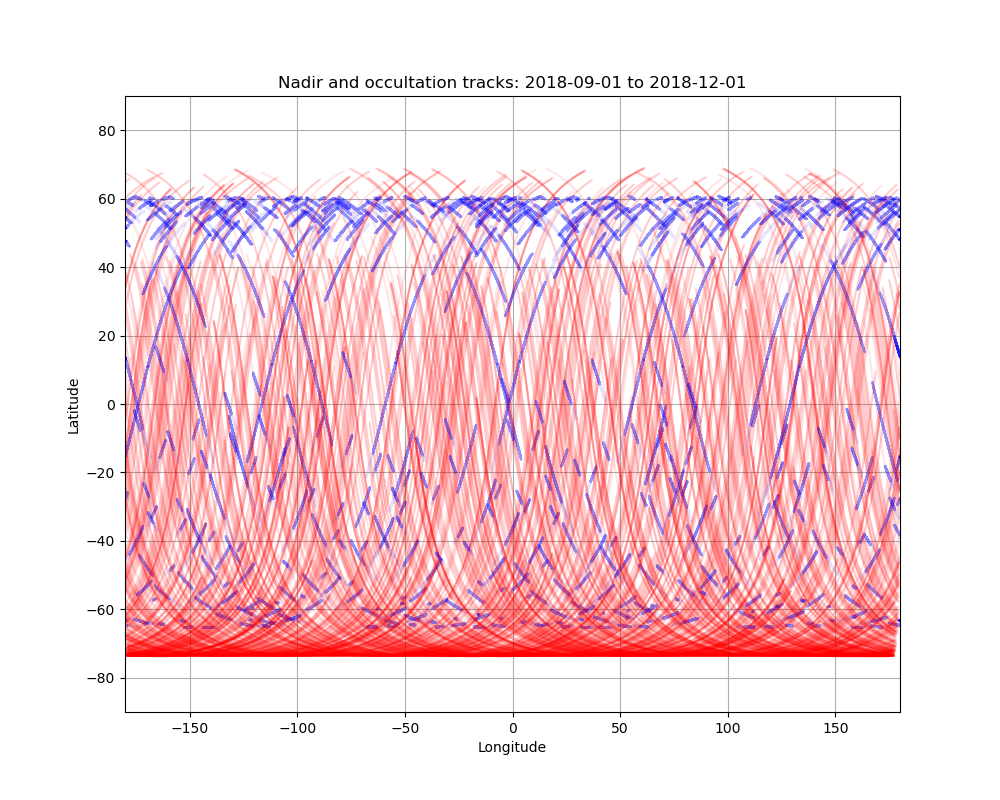
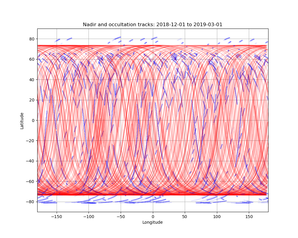
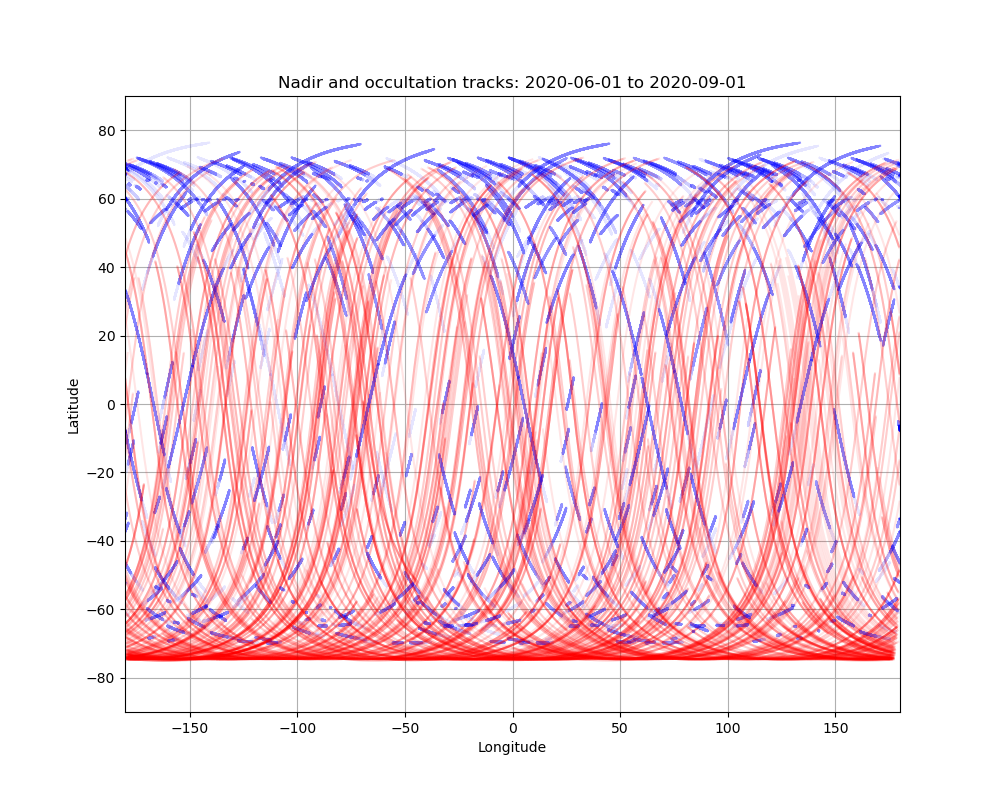
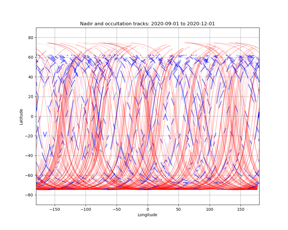
Below are maps showing nadir (red) and occultation (blue) coverage across the Martian surface for 3 month intervals since the beginning of the mission.
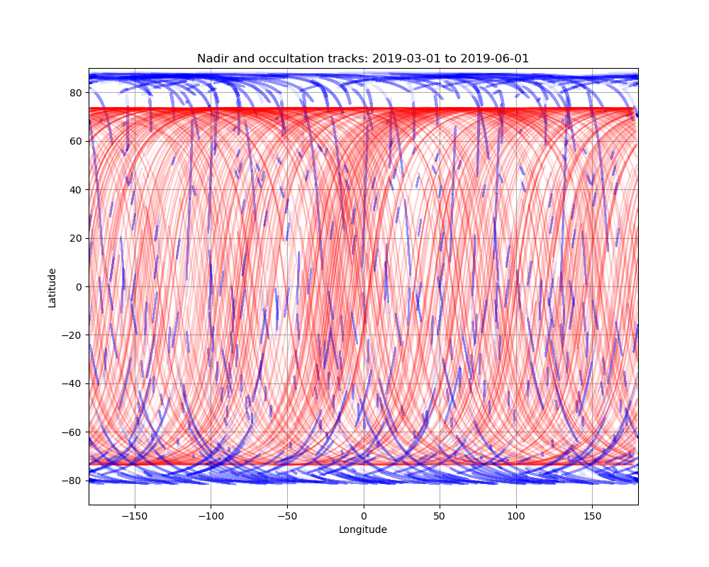
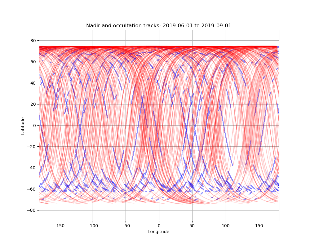

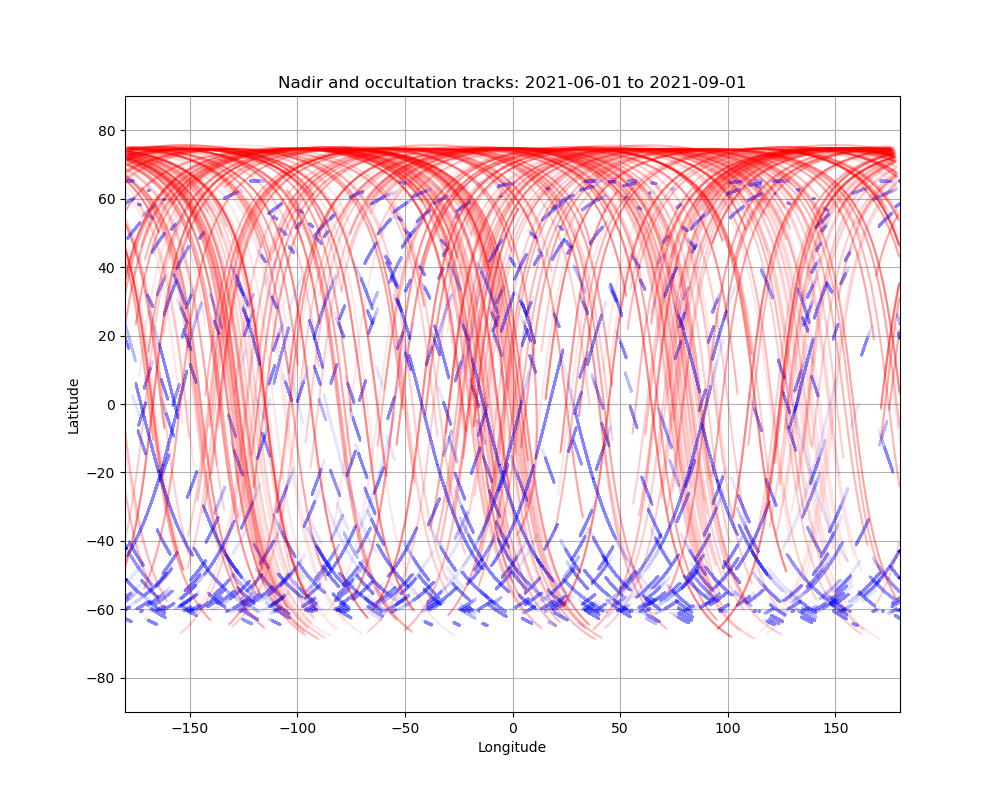
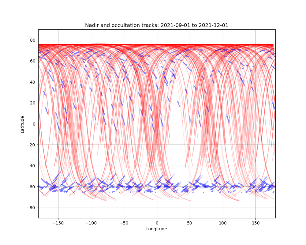
Last updated 17/05/2022
Made with presentations.meeting_updates.plot_so_lno_groundtracks.py
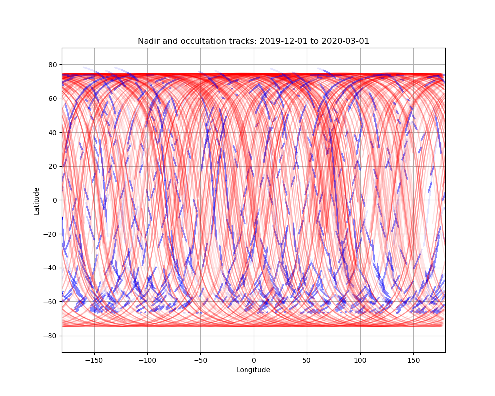
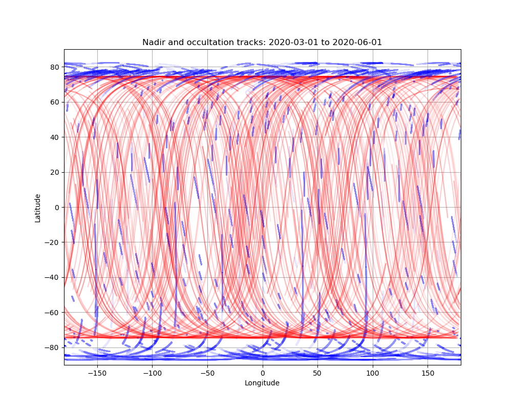
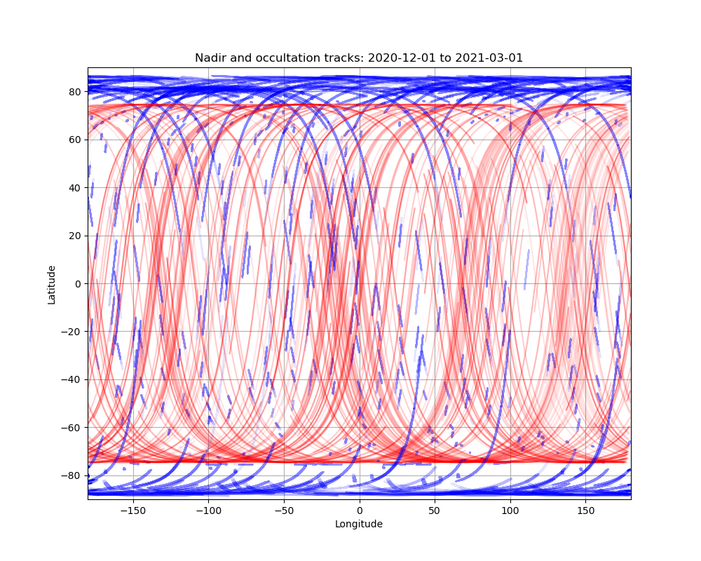
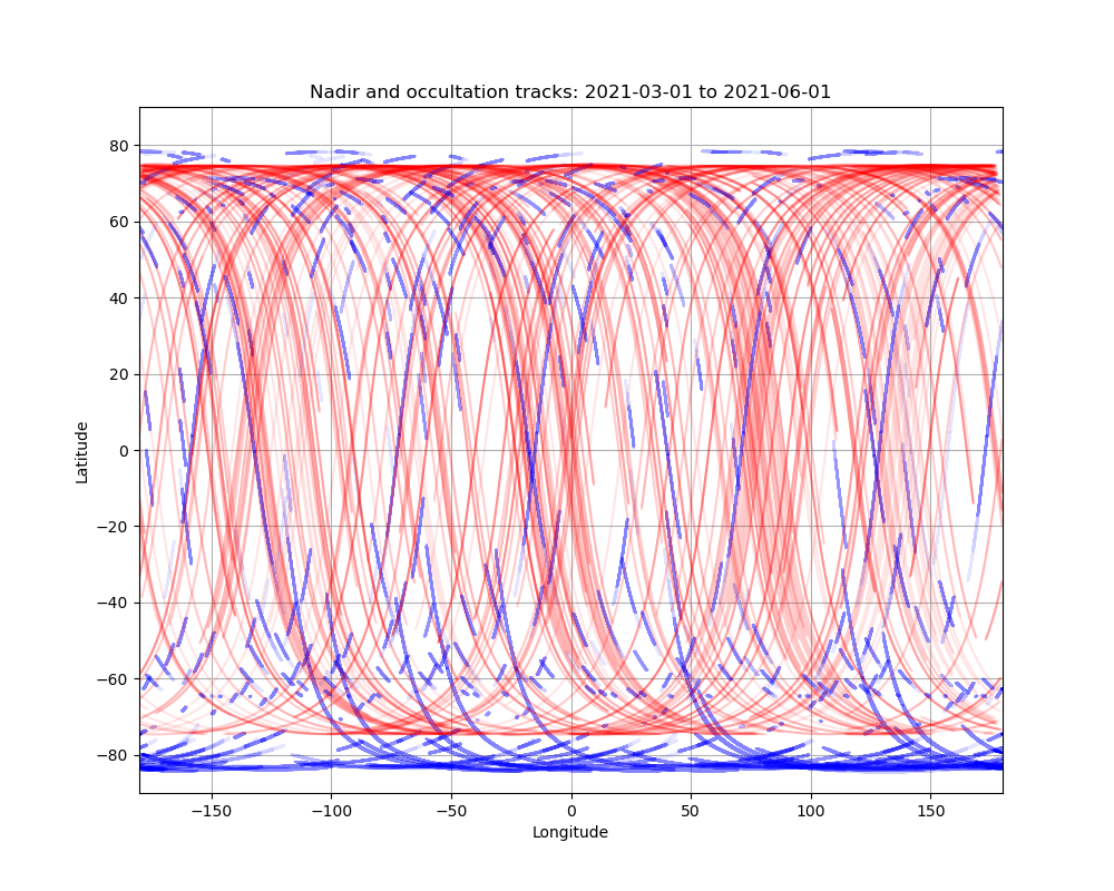
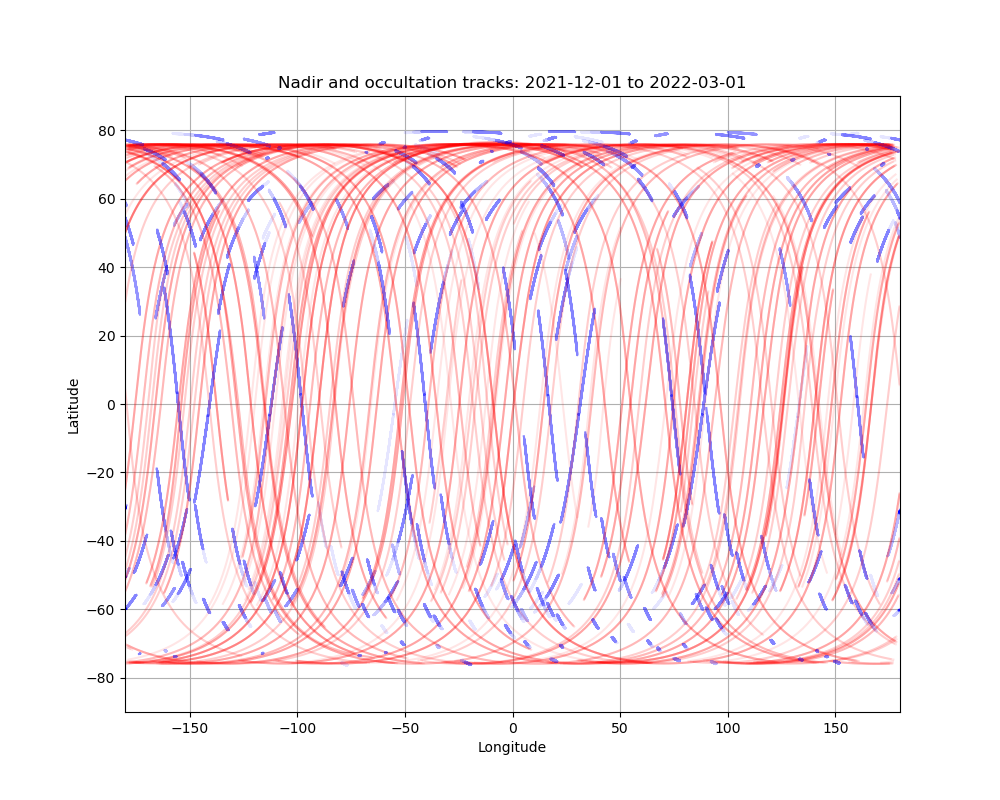
Below are maps showing nadir (red) and occultation (blue) coverage across the Martian surface for 3 month intervals since the beginning of the mission.
Last updated 17/05/2022
Made with presentations.meeting_updates.plot_so_lno_groundtracks.py